

SimplMap app for iPhone and iPad
Developer: Kim Bascle
First release : 29 Dec 2014
App size: 1.87 Mb
SimplMap is a marine navigation app for iPhone, iPod, and iPads.
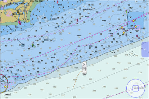
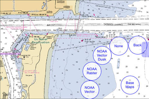
SimplMap allows users to connect to NOAAs online repository of marine chart data including NOAA ENC (Electronic Navigation Charts) Online Chart Server and NOAA RNC (Raster Navigation Charts) Online Chart Server to view high resolution marine navigation charts from your iOS device. You can additionally store chart imagery for offline viewing during times when your iOS device does not have WiFi or cellular connectivity. These public online services provide access to NOAA entire set of US coastal marine navigation charts. There are no in-app purchases required to unlock map data for your specific state or region.
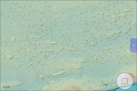
SimplMap also provides access to NOAAs high resolution bathymetry data, allowing users to view or overlay detailed color shaded bottom relief imagery on your map view.
Additional Features:
Pinch, Zoom, Pan, and Tilt maps and overlays
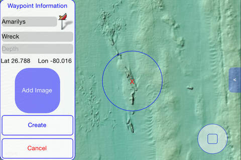
Create waypoints and routes based upon nautical chart and bottom imagery
Annotate waypoints with pictures
Select from multiple waypoint icon types
Import and Export waypoints in KML format using iTunes file transfer
Please Note:
SimplMap has not been certified for marine navigation and does not meet the requirements for chart carriage for regulated commercial vessels.
ENC, RNC, and Bathymetry data services are provided by NOAA. The availability and performance of these public data services are not controlled by SimplMap or its creators. Currently the NOAA data sets provide coverage of US coastal and marine navigation areas only. These charts do not provide coverage for inland navigation on lakes and rivers, or areas outside of the United States. For specific information on coverage, please reference the NOAA website.